


Adams 109, Adams County, Colorado
About
Outline

Summary
| Unique Area Identifier | 546185 |
| Name | Adams 109 |
| County | Adams County |
| State | Colorado |
| Area (square miles) | 30.71 |
| Land Area (square miles) | 30.21 |
| Water Area (square miles) | 0.50 |
| % of Land Area | 98.37 |
| % of Water Area | 1.63 |
| Latitude of the Internal Point | 39.83280770 |
| Longtitude of the Internal Point | -104.85395410 |
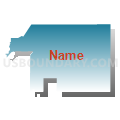
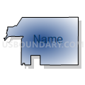
Maps


Graphs
Select a template below for downloading or customizing gragh for Adams 109, Adams County, Colorado


Neighbors
Neighoring Voting District (by Name) Neighboring Voting District on the Map
- Adams 103, Adams County, CO
- Adams 105, Adams County, CO
- Adams 106, Adams County, CO
- Adams 107, Adams County, CO
- Adams 108, Adams County, CO
- Adams 110, Adams County, CO
- Adams 111, Adams County, CO
- Adams 115, Adams County, CO
- Adams 116, Adams County, CO
- Adams 117, Adams County, CO
- Adams 83, Adams County, CO
- Denver 722, Denver County, CO
- Denver 723, Denver County, CO
- Denver 724, Denver County, CO
- Denver 728, Denver County, CO
- Denver 731, Denver County, CO
- Denver 748, Denver County, CO
Top 10 Neighboring County Subdivision (by Population) Neighboring County Subdivision on the Map
- Denver CCD, Denver County, CO (600,158)
- Brighton CCD, Adams County, CO (80,401)
- Commerce City CCD, Adams County, CO (29,615)
Top 10 Neighboring Place (by Population) Neighboring Place on the Map
- Denver city, CO (600,158)
- Thornton city, CO (118,772)
- Commerce City city, CO (45,913)
- Derby CDP, CO (7,685)
Top 10 Neighboring Unified School District (by Population) Neighboring Unified School District on the Map
- Denver County School District 1, CO (600,158)
- Brighton School District 27J, CO (77,537)
- Adams County School District 14, CO (36,462)
Top 10 Neighboring State Legislative District Lower Chamber (by Population) Neighboring State Legislative District Lower Chamber on the Map
Top 10 Neighboring State Legislative District Upper Chamber (by Population) Neighboring State Legislative District Upper Chamber on the Map
- State Senate District 25, CO (181,050)
- State Senate District 33, CO (160,926)
- State Senate District 24, CO (156,797)
Top 10 Neighboring 111th Congressional District (by Population) Neighboring 111th Congressional District on the Map
- Congressional District 2, CO (733,805)
- Congressional District 7, CO (678,410)
- Congressional District 1, CO (662,039)
Top 10 Neighboring Census Tract (by Population) Neighboring Census Tract on the Map
- Census Tract 41.06, Denver County, CO (10,138)
- Census Tract 85.39, Adams County, CO (8,437)
- Census Tract 87.09, Adams County, CO (7,656)
- Census Tract 85.23, Adams County, CO (7,586)
- Census Tract 83.88, Denver County, CO (6,962)
- Census Tract 87.06, Adams County, CO (5,436)
- Census Tract 85.38, Adams County, CO (5,305)
- Census Tract 88.01, Adams County, CO (4,752)
- Census Tract 83.86, Denver County, CO (4,511)
- Census Tract 88.02, Adams County, CO (4,075)
Top 10 Neighboring 5-Digit ZIP Code Tabulation Area (by Population) Neighboring 5-Digit ZIP Code Tabulation Area on the Map
- 80022, CO (42,699)
- 80239, CO (40,512)
- 80249, CO (23,404)
- 80640, CO (11,054)
- 80216, CO (10,924)
- 80238, CO (10,058)
- 80024, CO (228)